


Fully Editable PowerPoint USA and State Map Templates with City and County Names!
The editable PowerPoint US Map Templates created by PremiumSlides.com deliver a fast professional result. This is the most all-inclusive kit you can get. Watch it! It's that easy!
This ultimate US Map kit includes:
|
|

174 Slides included in this Ultimate US Map Kit for PowerPoint


Quick Facts
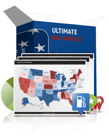
Fully Editable USA Maps
The PowerPoint US Map Templates are fully editable in size and color.
78 Markers and Pointers
Highlight specific locations with more than 78 markers and pointers.
Excel Micro Charts
Show sales and margin trends of several states or counties with excel based micro charts.
50 State Maps
Map versions of all 50 states are included. State Maps are organized by most important cities, counties and blank version.
How to Guide
The delivered How to Guide shows how to create customized us maps for your poweropint presentations.
Capitals and Cities Maps
All state maps show name tags of state, county, capital and most important cities.
PowerPoint US Map Special Kit! Value: $1547!

Boxes included in this kit
The biggest US Map Kit for PowerPoint includes templates of USA and its States Africa, and greate Map Markers and Charts. All templates are fully editable in size and color in your Microsoft PowerPoint. No third party plugins or add-ons needed! You do not have to install any new software.
Fully Editable US Maps for PowerPoint
The very detailed PowerPoint maps are fully resizable. Every state or county can be extracted or highlighted. For your convenience many sample maps are already included. They show you how to present your data the right way.

Capital & County Tags
The US state maps show tags of counties, capital and most important cities. All elements are grouped so it is easy to show and hide them. It is up to you to show state names or city names or just a blank map. Hiding and unhiding is done by just one click.

Many well-known city names are already tagged on the map. Simply choose the us state map you prefer and paste it in your own PowerPoint presentation.

50 States - Not just one US Map
All 50 States of the United States of America are included. They are organized by state and county. You can easily extract, colorize or highlight a county. All counties have name tags. This gives you the opportunity to have a closer look at specific regions. With the US Map Kit you have all maps you will ever need for data mapping.
Excel Micro Charts
What do you want to show on your US Maps most of the time? Trends! This is exactly why this kit is upgraded with Excel Micro Chart Templates. These little charts display trends and sales of your states or counties in bar, line or pie charts. Just add your data and you are done.

78 Markers for your US Maps
You see them on Google, Bing or Apple Maps and also in magazines every day. Professional markers and pointers on maps. Now you can showmtravel routes, regional offices and branches or upcoming target markets. The 78 markers will help your to point out specific locations. All markers are also fully editable in size and color. US Flag Makers are included as well.

Works with MS-Office 2007-13
The Ultimate World Map Kit is optimized for PowerPoint 2007-2013 and even PowerPoint for Mac. In Mac Version the Selection List Feature is not supported. A World map pptx presentation format is included for maximum PowerPoint features.


How to Guide included
This big package does not stop! You'll never stand alone. The premium How to Guide in pdf format shows you how to create your custom maps easily.
Selection List for highlighting Countries
For your convenience the maps of USA (not state maps) are upgraded with an alphabetical sorted selection list. So you can select your states through your selection pane and colorize them with just one click. Watch Video to see how easy it is!(Seletion List is not supported by Office for Mac)

Why should you buy the US Map here and no where else?
Because the benefit is ALWAYS yours! Here's what you'll get when you order your US Map Kit today:
Questions about Ultimate US Map Kit?
Do you have a questions about this product? Just ask, we are here to help.
How to buy?

Start creating professional PowerPoint Maps today!


