Vermont County Map Template for PowerPoint
Vermont County Map Template for PowerPoint - Company License is backordered and will ship as soon as it is back in stock.
Couldn't load pickup availability
Premium Features
Premium Features
- Resizable without loss of quality
- Fully editable in Size and Color
Download Information
Download Information
You receive an email with download link after your purchase.
Compatibility
Compatibility
These slides are compatible with all Microsoft PowerPoint Versions newer or equal to 2003.

Vermont County Map Template for PowerPoint
Premium Slides for PowerPoint.
Stand out and enhance your presentation with hiqh quality slides.
Description
Description
Premium PowerPoint Map of US State Vermont. This detailed PowerPoint Map Template shows Vermont counties, county names and biggest cities including the Vermont state capital. The Vermont PowerPoint Map is hand drawn and fully editable in size and color.
Specific territories can be highlighted easily with just 2 clicks in PowerPoint. The Vermont Map Template is a great benefit for showing sales data in this state.
Do not wait! Get this Premium Vermont Map Template for an unbeatable price today and impress your audience in your next meeting!
Specifications
Specifications
-
Slides
-
Delivery time
-
Powerpoint Version
-
Selection List (Maps only)
-
License
-
Editable
-
Color Variations
Payment & Security
Payment methods
Your payment information is processed securely. We do not store credit card details nor have access to your credit card information.
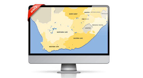
The map template of Vermont (VT) includes the following counties:
Addison, Bennington, Caledonia, Chittenden, Essex, Franklin, Grand Isle, Lamoille, Orange, Orleans, Rutland, Washington, Windham, Windsor
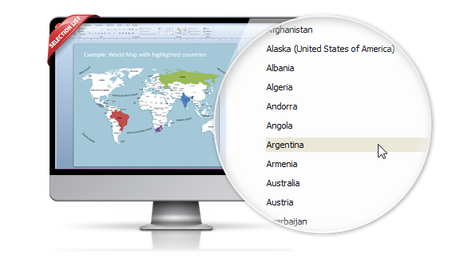
Effortless and fast – the PremiumSlides Selection Lists for PowerPoint Maps
Save your time and select the countries with our comfortable Selection list tool. Click on the desired country and color the shape with one simple click. All countries in the selection list are in alphabetic order and effortless to find. You can also select the state on your map, and the state wil be highlighted in the selection list. Most of our maps are delivered with a selection list. Please check product details. (Due to technical disadvantages of Microsoft Office for Mac, Selection Lists are only available for PC.)

Remarkable features are provided with this map template of Vermont
-

The map template of Vermont is fully editable in Microsoft PowerPoint
These very detailed PowerPoint maps are totally editable in size and color. Any country, county or state (depending on the map) can be extracted or highlighted. Because of the excellent quality you can resize any map with no loss of quality. This is relevant if you want to print your PowerPoint Slides.
-

State and Cities are shown on Vermont PowerPoint Map
This PowerPoint map is delivered with state and capital name tags. All views are well structured. Country and city tags can be hidden with just one click if you prefer a blank map.
-

Up to 14 Multiple Color themes for Vermont are already included
There are up to 14 different color themes shipped with all this PremiumSlides map package. You can switch all colors of your map with just one click. This makes it easy to use maps in your own presentation. The colors have been selected to look great in combination. To making use of PremiumSlides Maps for PowerPoint you do not have to be a design genius to have great looking slides in your presentation.
-

Direct download for Microsoft PowerPoint
We guarantee that all our products work with Microsoft Office newer than Office 2003. You can work with our maps and shapes not only in PowerPoint but likewise MS Word and MS Excel. All files even work on Office for Mac. Only the Selection list add on is not supported by Office for Mac. You do not need any new plugins or any other software! Just launch PowerPoint and work straight away. You can download your purchased map files and slides directly after purchase.
Vermont belongs to the region of the Northeastern United States.
The Census Bureau has designated four regions for the United States. Although there are other definitions, these four regions are generally used in classification systems and for data collection and research. These four regions have not changed since 1880, and is nowadays are commonly taken as a standard for data tabulation.
The Northeast region consists of the following nine states: the New England states of Connecticut, Maine, Massachusetts, New Hampshire, Rhode Island, and Vermont; and the Mid-Atlantic states of New Jersey, New York, and Pennsylvania. The American Northeast has a total area of 181,324 square miles (469,630 km²) with a land coverage of 162,257 square miles (420,240 km²).
The Northeastern region of the United States is the most economically developed, heavily populated, and culturally diversified region. Of the entire nation's 4 census regions, the Northeast is the second most urban, with 85 percent of its population residing within urban areas, led by the West with 90 percentage.
How to buy?