


Simple, fast and professional
- PremiumSlides Maps of Europe
Create stunning data maps of European countries for your next presentation. Including up to 14 color presets, your maps will integrate perfectly in your PowerPoint slides. These map templates of European countries can be colored, resized and also used in other MS Office programs such as Word or Excel. Download PowerPoint map templates directly after purchase.

Europe
-
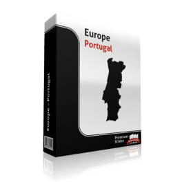
Portugal Map - Editable Map of Portugal - Template for PowerPoint
Premium PowerPoint Map of Portugal. This detailed PowerPoint Map Template shows Portugal states, biggest cities and the Portugal state capital. The Portugal PowerPoint Map is hand drawn and fully editable in size and color. Learn More$69.99Out of stock
-

Poland Map - Editable Map of Poland - Template for PowerPoint
Premium PowerPoint Map of Poland. This detailed PowerPoint Map Template shows Poland states, biggest cities and the Poland state capital. The Poland PowerPoint Map is hand drawn and fully editable in size and color. Learn More$69.99Out of stock
-
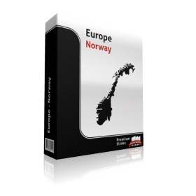
Norway Map - Editable Map of Norway - Template for PowerPoint
Premium PowerPoint Map of Norway. This detailed PowerPoint Map Template shows Norway states, biggest cities and the Norway state capital. The Norway PowerPoint Map is hand drawn and fully editable in size and color. Learn More$54.99Out of stock
-

Netherlands Map - Editable Map of Netherlands - Template for PowerPoint
Premium PowerPoint Map of Netherlands. This detailed PowerPoint Map Template shows Netherlands states, biggest cities and the Netherlands state capital. The Netherlands PowerPoint Map is hand drawn and fully editable in size and color. Learn More$54.99Out of stock
-
Montenegro Map - Editable Map of Montenegro - Template for PowerPoint
Premium PowerPoint Map of Montenegro. This detailed PowerPoint Map Template shows Montenegro states, biggest cities and the Montenegro state capital. The Montenegro PowerPoint Map is hand drawn and fully editable in size and color. Learn More$54.99Out of stock
-

Monaco Map - Editable Map of Monaco - Template for PowerPoint
Premium PowerPoint Map of Monaco. This detailed PowerPoint Map Template shows Monaco states, biggest cities and the Monaco state capital. The Monaco PowerPoint Map is hand drawn and fully editable in size and color. Learn More$54.99Out of stock
-
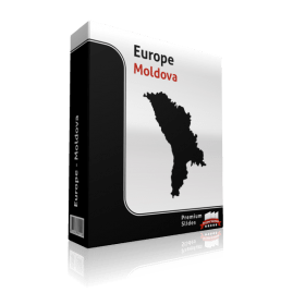
Moldova Map - Editable Map of Moldova - Template for PowerPoint
Premium PowerPoint Map of Moldova This detailed PowerPoint Map Template shows Moldova states, biggest cities and the Moldova state capital. The Moldova PowerPoint Map is hand drawn and fully editable in size and color. Learn More$54.99Out of stock
-
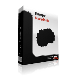
Macedonia Map - Editable Map of Macedonia - Template for PowerPoint
Premium PowerPoint Map of Mazedonia. This detailed PowerPoint Map Template shows Mazedonia states, biggest cities and the Mazedonia state capital. The Mazedonia PowerPoint Map is hand drawn and fully editable in size and color. Learn More$54.99Out of stock
-

Luxembourg Map - Editable Map of Luxembourg - Template for PowerPoint
Premium PowerPoint Map of Luxembourg. This detailed PowerPoint Map Template shows Luxembourg states, biggest cities and the Luxembourg state capital. The Luxembourg PowerPoint Map is hand drawn and fully editable in size and color. Learn More$54.99Out of stock
-
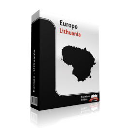
Lithuania Map - Editable Map of Lithuania - Template for PowerPoint
Premium PowerPoint Map of Lithuania. This detailed PowerPoint Map Template shows Lithuania states, biggest cities and the Lithuania state capital. The Lithuania PowerPoint Map is hand drawn and fully editable in size and color. Learn More$54.99Out of stock
European Map Templates for Microsoft Office PowerPoint - Direct Download and fully editable.
Display all your information on your Map templates of European countries. Do you wish to showcase routes, headquarters, branches, customer locations or other data by country? Not hard with PremiumSlides PowerPoint maps. You can show any kind of data on these maps. Include anything including, charts, icons, symbols and graphics on PremiumSlides maps. Work with our maps like you would like to work in PowerPoint.
Fully editable maps for Microsoft PowerPoint
These very detailed PowerPoint maps are completely editable in size and color. Each country, county or state (depending on the map) can be extracted or highlighted. Because of the top quality you can resize any map without loss of quality. This is relevant if you want to print your PowerPoint Slides.
Up to 14 Color themes for PowerPoint Maps are already included
There are up to 14 different color designs included with all the PremiumSlides maps. You can switch all colors of your map with just one simple click. This makes it straight forward to include maps in your own presentation. The colors have been chosen to look great together. To making use of PremiumSlides Maps for PowerPoint you do not have to be a design genius to showcase great looking slides in your presentation.
Simple and fast – the PremiumSlides Selection Lists for PowerPoint Maps
Save time and select the countries with our comfortable Selection list tool. Click on the preferred country and color the shape with one mouse click. All countries in the selection list are in alphabetic order and simple to find. You can also select the state on your map, and the state wil be highlighted in the selection list. The majority of our maps are delivered with a selection list. Please check product details. (Due to technical disadvantages of Microsoft Office for Mac, Selection Lists are only offered for PC.)
Download PowerPoint Maps of Europe instantly and you can even re-download
You can download your bought map files and slides directly after purchase, so you can start working with your PowerPoint map templates straight away. We even store your purchased map files on your PremiumSlides customer account. If you have a PC crash with damage to your data, you can re-download any of your slides. Or if you are on a business trip and forgot your presentation package, you can still have download your map files not matter where you are.
What do you receive with a PremiumSlides purchase? PPT, PTX, POT.
Soon after purchase we send you all files via email to your specified email address. You can open the files and start working straightaway in your Microsoft Office software.
Why do the PremiumSlides Maps have such good quality?
The most significant factor in the high quality is the number of polygons drawn in a map. The number of polygons is responsible for the detail of the map. The more polygons you have, the more detail you view. But there is a negative to this; if there are too many polygons, PowerPoint will become very slow and the file size will increase. Usually if you have multiple maps in one presentation, the file size can be very big and often times you may be unable to email your presentation. Then again less polygons bring less detail to the map. At PremiumSlides.com we found a way of perfecting the maps to have great detail by optimum performance and file size.
All Slides work on Microsoft Office, no plugin or extra software required.
We ensure that all our products work with Microsoft Office newer than Office 2003. You can work with our maps and shapes not only in PowerPoint but likewise MS Word and MS Excel. All products even work on Office for Mac. Only the Selection list add on is not supported by Office for Mac. You do not need any new plugins or any other software! Just launch PowerPoint and work right away.
PremiumSlides owns 100% copyright on all our products. Be on the safe side.
Each PowerPoint Map and every slide is created by PremiumSlides. We do not use open libraries or other components in our work. So you will never have any copyright difficulties, because we give you the right to use our work after purchase. These days this is more and more relevant because many free download sites have started suing organizations for using their free work for commercial purposes. With our products you avoid this old trap.
Basic facts about the European Continent you can use in your slide presentation.
The most expanded part of Europe is oftentimes described as being the Ural Mountains and the Ural River. On the southeast it is the Caspian Sea; and on the southern area the Caucasus Mountains, the Black Sea, and the Mediterranean. Also some sections of Azerbaijan, Georgia, Kazakhstan, Russia, and Turkey fall within both Europe and Asia. However in almost every instance the larger section is part of the Asian continent. Armenia and Cyprus, which lie entirely in Western Asia, are geopolitically considered as European countries.
Europe is the second-smallest continent
The European continent is the Earth’s second-smallest continent by surface area, covering about 9,948,000 square km (3,840,000 sq mls). This is about 2% of the Earth's surface area and about 6.8% of its total land area.
Europe is the third-most populous continent after Asia and Africa, with a population of 743 million. This is about 11 percent of the world's total population. Currently there are 290 different dialects spoken in Europe.
Europe's map includes forty-nine autonomous countries.
Among Europe's approximately forty-nine countries, Russia is the largest and most populated. Covering 39 percent of the {continent} and consisting of 15 % of its population. The Vatican City is the smallest when it comes to both area and population.
The states in alphabetical order are: Albania, Andorra, Austria, Azerbaijan*, Belarus, Belgium, Bosnia and Herzegovina, Bulgaria, Croatia, Czech Republic, Denmark, Estonia, Finland, France, Georgia*, Germany, Greece, Holy See (Vatican City), Hungary, Iceland, Ireland, Italy, Kazakhstan*, Kosovo, Latvia, Liechtenstein, Lithuania, Luxembourg, Macedonia, Malta, Moldova, Monaco, Montenegro, Netherlands, Norway, Poland, Portugal, Romania, Russia*, San Marino, Serbia, Slovakia, Slovenia, Spain, Sweden, Switzerland, Turkey*, Ukraine, and the United Kingdom. Countries indicated with * are shared with the Asian continent. Together these regions are also known as Eurasia.)
Europe’s climate has seasonal differences
Europe has a climate heavily affected by warm Atlantic ocean currents that temper winters and summers on much of the continent. Further from the Atlantic, seasonal variations are mildly greater than near the coastline.
Important details regarding the geography of Europe
The lowest point in Europe is the Caspian Sea in Azerbaijan-Kazakhstan-Russia, which is 28 m below sea level. The highest place in Europe is El'brus in Russia with a peak of 5,633 m.
Do not confuse the European Union with the European Continent
The European Union is basically a community based on economic and ethical values. It cannot be equated with the European continent. Not all countries within Europe are a member of the European Union. Countries need to meet certain requirements to become an associate of the EU. So take care if you are using both terms in your PowerPoint presentation.


