Details about Maryland County Map Template for PowerPoint
Premium PowerPoint Map of US State Maryland. This detailed PowerPoint Map Template shows Maryland counties, county names and biggest cities including the Maryland state capital. The Maryland PowerPoint Map is hand drawn and fully editable in size and color.
Specific territories can be highlighted easily with just 2 clicks in PowerPoint. The Maryland Map Template is a great benefit for showing sales data in this state.
Do not wait! Get this Premium Maryland Map Template for an unbeatable price today and impress your audience in your next meeting!
The map template of Maryland (MD) includes the following counties:
Allegany, Anne Arundel, Baltimore City, Baltimore, Calvert, Caroline, Carroll, Cecil, Charles, Dorchester, Frederick, Garrett, Harford, Howard, Kent, Montgomery, Prince George'S, Queen Anne'S, Somerset, St. Mary'S, Talbot, Washington, Wicomico, Worcester
Stunning features are delivered with this map template of Maryland (MD)
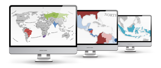
The map template of Maryland (MD) is fully editable in Microsoft PowerPoint
These extremely detailed PowerPoint maps are completely editable in size and color. Any country, county or state (depending on the map) can be extracted or highlighted. Because of the high quality you can resize any map with no loss of quality. This is relevant if you want to print your PowerPoint Slides.
State and Cities are shown on Maryland (MD) PowerPoint Map
This PowerPoint map is delivered with state and capital name tags. All views are well structured. Country and city tags can be hidden with just one mouse click if you prefer a blank map.

Direct download for Microsoft PowerPoint
We guarantee that all our products work with Microsoft Office newer than Office 2003. You can work with our maps and shapes not only in PowerPoint but likewise MS Word and MS Excel. All files even work on Office for Mac. Only the Selection list add on is not supported by Office for Mac. You do not need any new plugins or any other software! Just start PowerPoint and work right away. You can download your bought map files and slides immediately after purchase.
Facts and information about Maryland State you can use in your presentation.
The history of US State of Maryland (MD)
Maryland (MD) is also known as the Free State; Old Line State. The name Maryland is in honor of Henrietta Maria (queen of Charles I of England). The date of admission to the Union was on April 28, 1788 out of Crown Colony of Maryland. It is the 7th state to joining the other constituent entities. The motto of the state is: Fatti maschii, parole femine (Manly deeds, womanly words).
Geographic facts about Maryland (MD)
The total size of this US State is about 12,406 square miles. Therefore Maryland ranks in 42nd place among all other US States in terms of land area. Actually 9,705 square miles are covered by land and 2,7 square miles are covered by water. The mean elevation is 350 feet. Maryland's highest point is Backbone Mountain with a height of 3,36 feet. The lowest place is Atlantic Ocean, which is below sea level. Its geographic center can be found in Prince Georges County, 41/2 miles northwest of Davidsonville. Maryland is bordered by the following states: Delaware, Pennsylvania, Virginia, West Virginia.
Population and people of Maryland (MD)
In 2015, 6,006,401 people lived in Maryland. The majority of people do not live in the capital Annapolis. They live in the largest city Baltimore. The residents are called Marylander.
Industry and Agriculture of Maryland (MD)
Maryland is known for these industries: Electric equipment, food processing, chemical products, printing and publishing, transportation equipment, machinery, primary metals, coal, tourism. Maryland is significant producer of agricultural products, including Seafood, poultry and eggs, dairy products, nursery stock, cattle, soybeans, corn.
Maryland belongs to the region of the Southern US.
As reported by the Census Bureau the Southern United States frequently referred to as the American South, Dixie, or just the South, is one of the four geographic regions defined.
The accepted definition consists of 16 states. Due to the size of the population in this area, estimated to be about 114 million, the Census Bureau identified three smaller sub-regions. The South Atlantic States including Delaware, Florida, Georgia, Maryland, North Carolina, South Carolina, Virginia and West Virginia; The East South Central States consisting of Alabama, Kentucky, Mississippi and Tennessee; and The West South Central States consisting of Arkansas, Louisiana, Oklahoma, and Texas.
The Research Triangle Park in North Carolina (the world's largest) and the Cummings Research Park in Huntsville, Alabama (the world's fourth largest) are located in the American South.
Most of the biggest US companies are based in Atlanta and the neighboring area. These companies include The Coca-Cola Company, The Home Depot, Delta Air Lines and also some of cable television networks, such as the Turner Broadcasting System (CNN, TBS, TNT, Turner South, Cartoon Network), and The Weather Channel.
Because of the low company tax burden and the low cost of living, many companies have are based in the South. Nowadays the majority of Fortune 500 companies are based in this region. That's why the South has some of the lowest unemployment rates in the United States.
Additional Information for Maryland County Map Template for PowerPoint
| Manufacturer | PremiumSlides |
|---|---|
| Delivery Time | immediately - download |
| Colors | grey |
| Editable | fully editable |
| License | Standard |
| Mastersupport | No |
| PowerPoint Version | >PowerPoint Version 2003, PowerPoint Version 2007, PowerPoint Version 2010, PowerPoint Version 365 |
| Slides | 7 |
| Selection list | yes |
| State | Maryland |
Do you have a questions about this product? Just ask, we are here to help.


