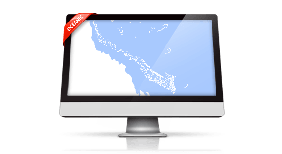
Include new Maps in your PowerPoint Presentation - PremiumSlides Maps of Oceanic
(1 products)Color an island on your map and paste it into any of your presentations. Easy, fast and perfect looking. No messing around with new software or add ons. Just use your standard PowerPoint installation. All maps and islands of the Oceanic continent can be resized and also incorporated in your MS Word or MS Excel documents. You can download the PowerPoint map templates instantly after purchase.
- Featured
- Best selling
- Alphabetically, A-Z
- Alphabetically, Z-A
- Price, low to high
- Price, high to low
- Date, old to new
- Date, new to old

PSSlides
Australia Map - Editable Map of Australia - Template for PowerPoint
From $64.99Unit price /Unavailable

Oceanic Map Templates for Microsoft Office PowerPoint - Direct Download and fully editable.
Present all your information on your Map templates of Oceanic islands and countries. Put anything including, charts, icons, symbols and graphics on PremiumSlides maps. Work with our maps like you would like to work in PowerPoint.
Fully editable maps for Microsoft PowerPoint
These highly detailed PowerPoint maps are entirely editable in size and color. Every country, county or state (depending on the map) can be extracted or highlighted. Because of the top quality you can resize any map with no loss of quality. This is important if you want to print your PowerPoint Slides.
Up to 14 Multiple Color themes for PowerPoint Maps are already included
There are up to 14 different color designs included with all the PremiumSlides map kits. You can switch all colors of your map with just one simple click. This makes it painless to use maps in your own presentation. The colors have been selected to look great in combination. To making use of PremiumSlides Maps for PowerPoint you do not have to be a design genius to have great looking slides in your presentation.
Easy and fast – the PremiumSlides Selection Lists for PowerPoint Maps
Save your time and select the countries with our comfortable Selection list tool. Click on the desired country and color the shape with one mouse click. All countries in the selection list are in alphabetical order and easy to find. You can also click the state on your map, and the state wil be highlighted in the selection list. A lot of of our maps are delivered with a selection list. Please check product details. (Due to technical restrictions of Microsoft Office for Mac, Selection Lists are only offered for PC.)
Why do the PremiumSlides Maps have such good quality?
The most important factor in the high quality is the number of polygons drawn in a map. The number of polygons is responsible for the detail of the map. The more polygons you have, the more detail you view. But there is a negative to this; if there are too many polygons, PowerPoint will become very slugigsh and the file size will go up. Particularly if you have multiple maps in one presentation, the file size can be very big and often times you may be unable to email your presentation. Then again less polygons bring less detail to the map. At PremiumSlides.com we found a way of optimizing the maps to have great detail by optimum speed and file size.
PremiumSlides owns 100% copyright on all our products. Be on the safe side.
Every PowerPoint Map and every slide is created by PremiumSlides. We do not use open libraries or other components in our work. So you will never have any copyright issues, because we give you the right to use our work after purchase. Nowadays this is more and more important because many free download sites have started suing companies for using their free work for commercial purposes. With our products you avoid this old trap.
Download PowerPoint Maps of Oceanic Islands and countries. directly and you can also re-download
You can download your bought map files and slides immediately after purchase, so you can start working with your PowerPoint map templates straight away. We even keep your purchased map files on your PremiumSlides customer account. In case you have a a PC crash with damage to your data, you can re-download any of your slides. Or if you are on a business trip and forgot your presentation package, you can still have download your map files not matter where you are.
All Slides work on Microsoft Office, no plugin or third party software required.
We guarantee that all our products work with Microsoft Office newer than Office 2003. You can work with our maps and shapes not only in PowerPoint but also MS Word and MS Excel. All files even work on Office for Mac. Only the Selection list add on is not supported by Office for Mac. You do not need any new plugins or any other software! Just launch PowerPoint and work without delay.
What do you obtain with a PremiumSlides purchase? PPT, PTX, POT.
Shortly after purchase we send you all files via e-mail to your specified email address. You can open the files and start working right away in your Microsoft Office software.
Details about the Oceania region that you can incorporate in your slide presentation.
The region of Oceania (or Australasia, as it is often referred to) has lots of different definitions. There is a geopolitical description that includes Australia and islands in the north and south of it. According to this definition, Oceania has a landmass of 3,291,903 sq miles. In 2010 this region had a population of 36,659,000. But there is also a wider definition. Little of the South Pacific is apparent at this scale, though Hawaii is just visible near the eastern horizon. Using this description the size of the area is much bigger with 4,237,700 sq miles and a population of 37.8 million people in 2010.
More frequently used is the smaller definition of Oceania. This includes the following 14 countries: Australia, Fiji, Kiribati, Marshall Islands, Federated States of Micronesia, Nauru, New Zealand, Palau, Papua New Guinea, Samoa, Solomon Islands, Tonga, Tuvalu and Vanuatu.
Oceania has a diverse mixture of economies. There is the developed and globally competitive financial market of Australia and the much less established economies that belong to many of its island neighbors. Australia and New Zealand are the only developed nations in this region.
Oceanic Continent Maps
The Oceanic continent is a region centered on the islands of the tropical Pacific Ocean. The term is often used more particularly to represent a continent comprising Australia and proximate islands. Biogeographically it is used as a synonym for either the Australasian economic zone (Wallacea and Australasia) or the Pacific economic region (Melanesia, Polynesia, and Micronesia, except both New Zealand and mainland New Guinea). There are actually different points of views on what constitutes Oceania. These range from its three subregions of Melanesia, Micronesia, and Polynesia to, more broadly, the entire insular region between Southeast Asia and the Americas, including Australasia and the Malay Archipelago. Geopolitically, Oceania comprises of Australia and the nations of the Pacific from Papua New Guinea east, but not the Malay Archipelago or Indonesian New Guinea.
Your cart
-
EXTREMELY CUSTOMIZABLE
Fully editable templates and maps.
-
UINLIMITED COLORS
Multiple colors already included.
-
100% POWERPOINT
No extra Software needed.
-
INSTANT ACCESS
Download instantly after purchase.